
Heads up: the makers say this app talks to services that aren’t open source.
This download comes from F-Droid, a trusted library of free open-source apps. Need help installing?
What it looks like
About this app
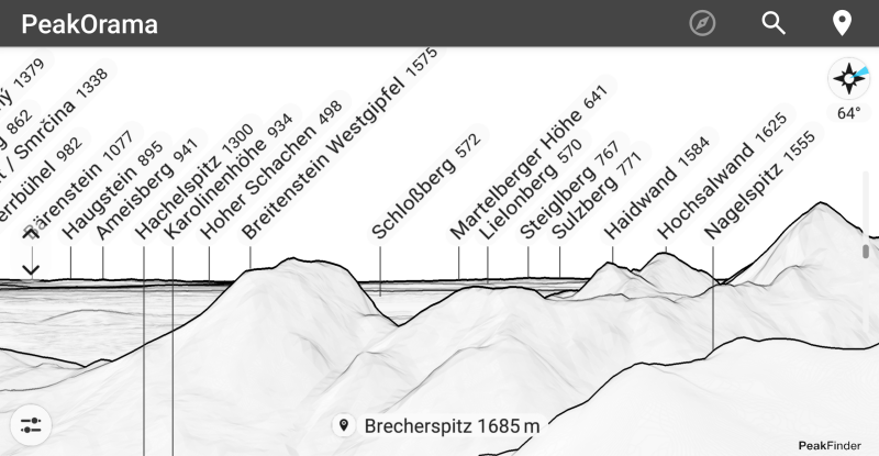
PeakOrama draws the skyline around you and labels every peak in it. Hold your phone up on a hike or at a viewpoint, and the outline on screen tells you which mountain is which.
You can use your current position or search for any place in the world. The view follows your phone's compass, or you can spin it with your finger; if the compass reads a little off, there is a setting to correct it.
It needs a working internet connection, and it downloads roughly 5-10 MB of terrain for each new location, so watch your data on mobile. There is no way to drop your own marks on the view.
From the app’s home page
- See the codeHow it’s made, every line is public
- Questions & commentsTalk with the people who make it
- Report a problemTell the makers something is broken
- All versionsOlder downloads and what changed
- LicenseThe rules for using and sharing it
More like this
 Trail Sense
Turns your phone's sensors into survival tools
Trail Sense
Turns your phone's sensors into survival tools
 Meshtastic
Text your friends with no phone signal at all
Meshtastic
Text your friends with no phone signal at all
 c:geo
Find and log geocaches straight from your phone
c:geo
Find and log geocaches straight from your phone
 Compass
A simple, beautiful compass
Compass
A simple, beautiful compass
 MB Compass
A clean compass app with no ads or tracking
MB Compass
A clean compass app with no ads or tracking
 CoMaps
Offline maps and directions that keep your trips private
CoMaps
Offline maps and directions that keep your trips private